 Marrakech Guidebook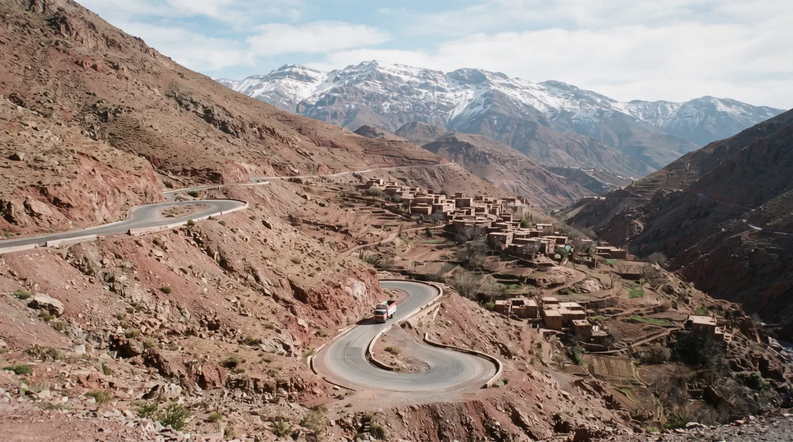
Atlas Mountains
The Atlas Mountains south of Marrakech are the High Atlas, and the part of them a visitor actually enters is Toubkal National Park, created in 1942 as Morocco's first national park and still the country's busiest mountain destination at around 40,000 visitors a year. This page carries what the park's own management plan says, the refuge tariff, the snow season and the compulsory-guide question that no Moroccan text answers. The village at the trailhead has its own page at Imlil, the other valley is the Ourika, and the city is on the Marrakech guide homepage.
Quick answer What the park is, what it costs, the guide question and the snow season
Toubkal National Park was created in 1942, Morocco's first, and takes about 40,000 visitors a year. No Moroccan authority publishes an entry fee, a permit or a hiker registration, and no Moroccan text makes a guide compulsory for a walker.
Key takeaways
- Two official figures for the park's size disagree: 38,000 hectares on Morocco's own biodiversity clearing-house and 102,009 hectares in the park's 2018 management plan. Both are government sources and we print both rather than pick one
- A full-day walk between Berber villages with lunch is listed at $22.78 and stays in the valleys; the summit is a two-day effort from Imlil, not a day trip
- The Refuge du Toubkal at 3,207 m has a published tariff: $32.00 (300 MAD) a night in winter for a non-member, dropping to $26.60 (250 MAD) in summer. Compare the rest of the region on the day trips page
Key facts
Opening hours
| Open all seven days per the Al Haouz provincial tourist office listing, with no times published | |
|---|---|
| Six entry gates mark the core zone; beyond them no vehicle may go |
Closed None published. The constraint is snow, not a calendar
Admission
- Adult
- Free. No official source publishes a park entry fee, a permit or a registration charge
- Reduced
- Refuge du Toubkal at 3,207 m, winter: $14.91 (140 MAD) for CAF Morocco members, $21.30 (200 MAD) for alpine-club members from abroad, $32.00 (300 MAD) for non-members
- Free
- Refuge summer rates $12.78 / $19.17 / $26.60 (120 / 180 / 250 MAD); breakfast $5.33, lunch $10.65, dinner $10.65; hot shower 10 dirhams
Planning it
- Time needed
- Not stated by the park. The tourist board's own line on the summit is that 'the effort takes two days'; the valley day walks from Marrakech run eight to nine hours door to door
- Book ahead
- Recommended — a few days
- Address
- Parc National de Toubkal, central High Atlas between the N'fis valley to the west and the Ourika valley to the east, Province d'Al Haouz
There is no park ticket to compare, so this table compares the three ways people actually spend money on the High Atlas: the refuge that does publish a tariff, and the two day products that carry you out of the city and back. Refuge figures are the Club Alpin Francais de Casablanca tariff sheet for the 2025 and 2026 seasons; tour prices are GetYourGuide listings read in Q3 2026.
Are you paying to enter something, or paying for the drive and the person who knows the path?
| Option | What it costs | Includes | Cancel | Book |
|---|---|---|---|---|
| Refuge du Toubkal, the official mountain hutAnyone going high enough to sleep at 3,207 m, which means the summit attempt rather than a day out | $32.00 (300 MAD) winter, $26.60 (250 MAD) summer for a non-member | A bed at 3,207 m; meals extra at $5.33 breakfast and $10.65 a main; hot shower 10 dirhams | Not stated on the tariff sheet | Official site |
| Full-day hiking trip with lunchWalkers who want two to three hours on their feet between villages and a lunch that is already arranged | $22.78 listed | Return transport, guide, lunch, about nine hours, walking scaled on the day | Free up to 24 hours before | Check Availability |
| Five valleys day tour with lunchAnyone who wants the landscape from the road, with short walks rather than a hike | $80.20 listed | Return transport, tea and lunch stops, about eight hours, more driving than walking | Free up to 24 hours before | Check Availability |
The refuge tariff is the only published price anywhere in this park. Member rates of $14.91 (140 MAD) in winter and $12.78 (120 MAD) in summer need an alpine-club card, and rates for club members resident outside Morocco sit in between at $21.30 and $19.17 (200 and 180 MAD). A third-party site publishes euro figures for the same hut that do not reconcile with the club's own dirham sheet; the dirham sheet is what we quote.
Ways into the High Atlas from Marrakech, compared
Two day products and one that adds the Ourika valley to the same drive. Prices are the GetYourGuide listings read in Q3 2026, in US dollars as the platform shows them.
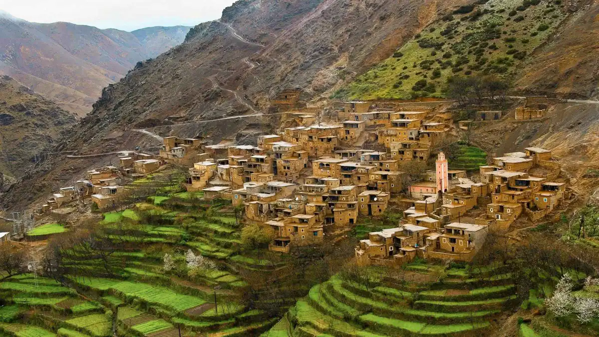 from $22.78
From Marrakech: Atlas Mountains Full-Day Hiking Trip with Lunch
listed at $22.78
Nine-hour Atlas day trip built around a two to three hour hike between Berber villages, with lunch. The operator says the walking can be lengthened or shortened on the day.
Check Availability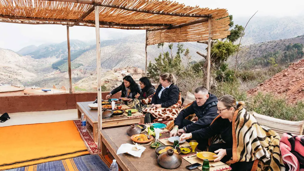 from $80.20
Marrakech: Atlas Mountains and 5 Valleys Day Tour with Lunch
listed at $80.20
Eight-hour drive through the Atlas foothills and five valleys with stops for tea and lunch, pickup included. More driving and viewpoints than walking.
Check Availability from $27.87
Marrakech: Imlil Atlas Mountains Day Trip with Lunch
listed at $27.87
Full-day trip to Imlil at the foot of Toubkal with lunch and a hike scaled to your fitness. Guides run it in English, Arabic or French.
Check AvailabilityPrices, ratings and details are the platform's own, checked in Q3 2026; dollar figures are the listed prices — the platform bills in your account's currency.
What Toubkal National Park actually is, and how big nobody agrees
The park is the reason the range is walkable and the reason parts of it are not drivable. Its own documents are the best source on it, and two of them disagree with each other in a way worth printing.
Toubkal National Park was created in 1942 and is Morocco's first national park. It sits in the central High Atlas, bounded by the N'fis valley to the west and the Ourika valley to the east, and it is managed by the forestry administration, now the Agence Nationale des Eaux et Forets. Ten communes intersect it; on the trailhead side that commune is Asni, with 13,195.68 hectares inside the boundary.
Then the numbers split. Morocco's own biodiversity clearing-house records the park at 38,000 hectares. The park's 2018 management plan, written by the forestry administration's regional directorate in Marrakech, and the agency's own park page both give 102,009 hectares.
Both figures are Moroccan government publications. The larger one is more recent and more specific and it is the figure the park uses about itself, but we are not going to quietly pick a winner in a disagreement between two arms of the same ministry.
| Fact | Figure | Source |
|---|---|---|
| Year created | 1942, Morocco's first national park | CHM Maroc, Departement des Eaux et Forets |
| Area, version one | 38,000 hectares | Moroccan CBD clearing-house entry |
| Area, version two | 102,009 hectares | Park management plan, Mission III, November 2018, and the ANEF park page |
| Visitors a year | About 40,000 | ANEF: 'le site privilegie du tourisme de montagne au Maroc' |
| Distance from Marrakech | 70 km per the provincial tourist office, 75 km per ANEF | Both official, both published |
The highest ground is well surveyed: Jbel Toubkal at 4,167 m, Ouenkrim at 4,089, the Tazarhart plateau at 3,995, Aksoual at 3,910, Ineghmar at 3,892, Bou Iguenouane at 3,882, Tichki at 3,753 and Azrou Tamadout at 3,664. Three perennial rivers rise on the north flank, the N'fis, the Rherhaya and the Ourika, which is why the valleys below carry water when the plain does not.
One more thing the park publishes about itself and almost nobody repeats: its ecomuseum, open since 2012, sits between Asni and Imlil, four kilometres from one and thirteen from the other. In 2014 it received 2,469 visitors, 43 per cent of them international tourists and 38 per cent school groups. Against 40,000 visitors a year to the park, that is a building almost every walker drives past.
Designation, area and summit list from the Moroccan biodiversity clearing-house entry for the park; area, visitor numbers, ecomuseum and commune breakdown from the park's own Plan d'Amenagement et de Gestion, Mission III, November 2018, and the archived ANEF park page. The park's public website, parc-national-toubkal.ma, returned HTTP 402 and could not be read in Q3 2026.
Is a guide compulsory in the Atlas Mountains? What the law actually says
This is the single most repeated claim about walking here and the one with the least behind it. We went looking for the rule in Moroccan law and could not find it, and the honest answer has three parts.
First, the law that exists. Loi 05-12 regulates the profession of tourism guide: who may work as one, in two categories, of which the relevant one is the guide des espaces naturels, whose job is defined as accompanying and assisting tourists on excursions and hikes in natural sites including mountains and deserts, on routes passable without climbing or mountaineering technique. Article 5 says nobody may practise the profession without an approval from the competent administration.
The prohibition binds the guide, not the walker. Nothing in the ministry's own page on the profession obliges a tourist to hire one.
Second, the law that governs the park. Loi 22-07 on protected areas contains the word 'guide' zero times in its full text. What it does contain, in article 18, is a general provision that circulation, camping and low overflight inside a protected area require the permission of the competent administration in the framework of authorised management, research or training activity.
Whether that provision bites on Toubkal is unresolved: the park was created in 1942 by arrete viziriel, a decree sets out how such pre-existing parks are reclassified under the 2010 law, and no confirmation that Toubkal has been reclassified could be found. In practice nothing official announces a hiker permit and no application process is published anywhere.
Third, the claim itself. The widely repeated rule, that since 2018 or 2019 the provincial authorities have required an accredited guide on the corridor from the trailhead to the refuge and to the summit, with checkpoints beyond Aroumd, appears only on blogs and tour-operator pages. No provincial decree, ministry page, forestry-agency page, gendarmerie notice or foreign-office text stating it could be located.
The UK Foreign Office tells hikers in the Atlas to research trails, pack water and clothing, hire a professional guide and insure themselves. That is advice, and it is framed as advice.
So the position we can defend: a guide is not established as a legal requirement for a walker by any Moroccan text we could read, and the park's own rules were unreachable, so we are not stating the opposite flatly either. The honest reasons to hire one are route-finding above the treeline, weather that changes inside an hour, and the refuge. If you do hire, the licence is real and checkable: a guide des espaces naturels carries a professional card and a badge under articles 5 and 10 of loi 05-12, and asking to see them costs nothing.
Loi 05-12 as published in the Ministry of Tourism's legal-texts library and the ministry's page on the guiding profession; loi 22-07 on protected areas searched in full for the word 'guide', which does not appear; the advisory wording is the UK Foreign Office Morocco travel advice. All read in Q3 2026.
The six gates, and where the road stops
The one access rule the park does publish is about vehicles, and it is the sentence that defines what a High Atlas day actually involves.
The management plan states that the core zone is marked by six entry gates at which vehicles may go no further. Its own words: 'Les vehicules ne peuvent y circuler. Les deplacements doivent alors se faire a pieds ou a dos de mulet.' Movement beyond the gates is on foot or on the back of a mule.
That is the whole of the published access regime, and it says nothing about guides, tickets or permits.
On the ground this is why the trailhead matters more than the park boundary. The tarmac ends at Imlil, and the traffic register confirms it: 1,170 vehicles a day on the 16 km of provincial road from Asni to Imlil in 2023, which is a surfaced road with real traffic, not a four-wheel-drive track. Above the village the transport is mules, and the mule is not a picturesque detail but the load-carrying system the whole valley economy runs on.
The park's plan also records the older road numbering, describing access 'depuis Imlil via Asni par la route regionale R203 puis la route provinciale P2005', and a second approach from Oukaimeden by P2017 then P2030. The 2023 traffic register numbers that same Asni to Imlil section RP 2015. Two official documents, two numbers, five years apart, and no document reconciling them.
Follow the signs rather than the number.
Gate rule and the quoted sentence from the park's Plan d'Amenagement et de Gestion, Mission III, 2018; traffic and section lengths from the CNER Recueil du Trafic Routier 2023, read in Q3 2026.
The snow season, in the park's own words
Marrakech is a hot city with a snowline visible from its rooftops, and the gap between the two is bigger than visitors expect.
The management plan describes the Toubkal massif as having 'un climat exceptionnel pour la region', with snow cover from September to May and temperatures dropping below minus twenty degrees, alongside strong sunshine even in winter. A large part of High Atlas precipitation falls as snow, residual neve can survive the summer at altitude, and total snow depth rarely exceeds 1.5 metres except in gullies, drifts and avalanche run-outs.
Read that against the city. Marrakech's own weather station sits at 468 metres and the national meteorological service's 1991 to 2020 normals give a mean daily maximum of 37.7 degrees in July. The refuge is at 3,207 metres and the summit at 4,167.
A nine-hour day trip in a T-shirt in April is entirely reasonable in the valleys and entirely unreasonable four hundred metres higher up.
| Altitude | What is there | What the season means |
|---|---|---|
| 468 m | Marrakech, the Menara station | Mean daily maximum 37.7 C in July, 19.1 C in January |
| About 1,700 m | The trailhead villages and the day walks | Cool in winter, walkable all year, snow on the tracks after storms |
| 3,207 m | Refuge du Toubkal | Winter tariff runs 1 November to 30 April, which is the season the club itself recognises |
| 4,167 m | Jbel Toubkal summit | Snow September to May, temperatures below minus twenty, a crampons-and-axe route in winter |
Summer has its own constraint that nobody warns about. High pasture from the trailhead douar runs from the beginning of July to the end of September, so the valleys above the villages in high summer are working grazing ground with animals, herders and their camps on them. It is not wilderness and it is not empty.
Snow regime and pasture season quoted from the park's 2018 management plan; city normals from the WMO World Weather Information Service entry for Marrakech, supplied by Morocco's Direction de la Meteorologie Nationale for 1991 to 2020; station elevation from the peer-reviewed literature. Read in Q3 2026.
The Refuge du Toubkal, and what a night there costs
The one place in this park with a published price list, and the reason the summit is a two-day trip rather than a long one.
The Refuge du Toubkal, still called the Neltner by everyone who has been there, sits at 3,207 metres and was built in 1999. It is run by the Club Alpin Francais de Casablanca, an association recognised as being of public utility, created in 1946, which also runs the Tazaghart refuge and the Oukaimeden chalet. The club publishes a dated tariff sheet, and that sheet is the honest anchor for what the mountain costs.
| What | Winter, 1 November to 30 April | Summer, 1 May to 31 October | Who pays it |
|---|---|---|---|
| Overnight | $14.91 (140 MAD) | $12.78 (120 MAD) | Members of the Casablanca, Tangier or Rabat alpine clubs |
| Overnight | $21.30 (200 MAD) | $19.17 (180 MAD) | Alpine-club members resident outside Morocco |
| Overnight | $32.00 (300 MAD) | $26.60 (250 MAD) | Everyone else |
| Meals | Breakfast $5.33, lunch $10.65, dinner $10.65 | Same in both seasons | Everyone |
| Hot shower | 10 dirhams | 10 dirhams | Everyone, paid to the caretaker |
Member rates need the alpine-club card, so most visitors are in the third row. A second hut, Les Mouflons, stands at the same site, privately built and run by a man from the trailhead village, six hundred square metres of single and family rooms with separate showers plus dormitories, stating that it is open all year. It publishes no prices and says nothing about guides or permits.
A word of caution about the figures you will find elsewhere. A third-party site publishes euro tariffs for the club's hut, twenty euros a night for members in summer and so on, which do not reconcile cleanly with the club's own dirham sheet, and that domain is not linked from the club's site anywhere. Where a price is disputed, take the one the operator publishes itself.
Tariffs from the Club Alpin Francais de Casablanca sheet dated 5 June 2025, linked from the club's refuges page; second hut details from its own site. Read in Q3 2026. Dirham conversions at the site's stated rate of 1,000 MAD to $106.52.
Five Things Most Visitors Do Not Know About The Atlas Mountains
Each line carries its source in brackets. Where the record is silent we say so rather than filling the gap.
- The park has two official areas, 38,000 hectares and 102,009 hectares, published by two arms of the same ministry (CHM Maroc clearing-house entry; Plan d'Amenagement et de Gestion, Mission III, 2018).
- No Moroccan text makes a guide compulsory for a walker: the guiding law binds the guide, and the protected-areas law does not contain the word (loi 05-12; loi 22-07, searched in full).
- The only published access rule is that vehicles stop at six gates and movement beyond them is on foot or by mule (park management plan, 2018).
- The park takes about 40,000 visitors a year, and its own ecomuseum between Asni and Imlil took 2,469 in 2014 (ANEF park page; management plan).
- The park's public website has been offline throughout our research, returning HTTP 402, so its current rules are unreadable by anyone (parc-national-toubkal.ma, checked in Q3 2026).
Also unpublished: any park entry fee, any hiker registration, any permit application, and any official statement on road access or reconstruction in the valleys after the 2023 earthquake.
In The High Atlas: What To Do, And What Not To
Every line here is argued above, reduced to what you decide before you leave the city.
Do
- Treat the summit as two days, which is what the national tourist board itself says, and the valley day walks as the day-trip option
- Carry the refuge tariff with you, since $32.00 (300 MAD) a night for a non-member is the only published price in the whole park
- Ask a guide for the professional card and badge required by articles 5 and 10 of loi 05-12, because the licence is real and checkable
- Assume snow from September to May above about three thousand metres, whatever the city thermometer says
- Expect the valleys above the villages to be working pasture between early July and late September
Don't
- Don't pay a fee to anyone claiming to collect park admission, since no authority publishes one
- Don't repeat the checkpoint story as fact; no decree, ministry page or foreign-office text supports it
- Don't plan to drive into the core zone, because six gates stop vehicles and everything past them moves on foot or by mule
- Don't take a euro price for the refuge from a site the alpine club does not link to
- Don't confuse the two valleys: the road to the trailhead is the R203 through Asni, not the Ourika road
Atlas Mountains map: the park, the summit and the way in
The park centroid, the summit, the trailhead village where the tarmac ends and the city the drive starts from. Coordinates are Wikidata reference points.
Coordinates are the Wikidata P625 values for Toubkal National Park, Jbel Toubkal, Imlil, Sti Fadma and Jemaa el-Fna, verified in Q3 2026.
Next, from the High Atlas
The three places a mountain day is usually weighed against, and what separates them.
Imlil
Where the road stops and the mules start. The Imlil page has the road sections, the flood-risk finding and the security question that Canada names and Britain does not.
The trailhead, 64.8 km by roadOurika Valley
A river day rather than a mountain day, with seven waterfalls at the head of it and a flood record worth reading first. The Ourika page has the road correction and the warning system.
The eastern boundary valleyDay trips from Marrakech
Drive time, what a coach will and will not carry you to, and the do-it-yourself fare where one is published. The day trips hub puts the mountains beside the coast and the desert.
All eight comparedAtlas Mountains questions
Do you need a guide to hike in the Atlas Mountains?
No Moroccan text we could read makes one compulsory for a walker. Loi 05-12 licenses the guide rather than the walker, and loi 22-07 on protected areas does not contain the word 'guide' at all. The UK Foreign Office advises hiring one, which is advice and not law. The park's own website is offline, so we cannot rule out a local rule, and the practical reasons to hire remain route-finding, weather and the refuge. A guided walking day settles the question by including one.
Is there an entry fee for Toubkal National Park?
None is published. No entry fee, permit price or registration charge appears in the park's own 2018 management plan, on the forestry agency's park page or on Morocco's biodiversity clearing-house. The only published tariff inside the park is the refuge, at $32.00 (300 MAD) a night in winter for a non-member.
How high is Mount Toubkal and how long does it take?
Jbel Toubkal is 4,167 m, the highest summit in North Africa. The Moroccan tourist board's own line is that 'the effort takes two days', which is why the summit is not a day trip from the city and why the refuge at 3,207 m exists. Day products from Marrakech, such as the five valleys tour, stay in the valleys.
When is there snow in the High Atlas?
The park's own management plan records snow cover from September to May with temperatures dropping below minus twenty degrees, and notes that residual neve can survive the summer at altitude. Total depth rarely exceeds 1.5 metres except in gullies, drifts and avalanche run-outs. Marrakech, meanwhile, averages a daily maximum of 37.7 degrees in July at 468 m.
How far are the Atlas Mountains from Marrakech?
Two official figures, both published: the Al Haouz provincial tourist office says the park is 70 km south of Marrakech, and the national forestry agency says 75 km. By road to the trailhead the distance is 64.8 km, summed from the official section lengths of the regional and provincial roads through Tahannaout and Asni.
Can you drive into Toubkal National Park?
Only as far as the gates. The park's management plan states that the core zone is marked by six entry gates at which vehicles may not proceed, and that movement beyond them is on foot or on the back of a mule. That is the only access rule the park publishes, and it says nothing about tickets or guides.
What does the Refuge du Toubkal cost?
The Club Alpin Francais de Casablanca publishes a dated tariff: winter $14.91 (140 MAD) for its own members, $21.30 (200 MAD) for alpine-club members from abroad and $32.00 (300 MAD) for everyone else; summer $12.78, $19.17 and $26.60 (120, 180 and 250 MAD). Breakfast is $5.33 (50 MAD), lunch and dinner $10.65 (100 MAD) each, and a hot shower is 10 dirhams paid to the caretaker.
Where the High Atlas fits in a Marrakech trip
The routing, and the one sentence that decides it.
If you have one spare day and want to walk, take the valley hiking trip: two to three hours on your feet, a lunch in a village house and back in the city for dinner. If you have one spare day and do not want to walk, take the five valleys drive, which is a viewpoints day with short stops. If you want the summit, budget two days, a night at 3,207 metres and a season without snow on the route, and start from Imlil.
What the mountains will not do is substitute for the desert. The stone hills at Agafay are 35 minutes from the medina and look nothing like this, and the Sahara dunes are 553 km away at Merzouga. The day trips hub sets all of them side by side, and the Marrakech guide homepage has the city itself.
The Atlas Mountains On Film: Valleys, Villages And The Drive Up
Three filmed days that show what the standard trip from Marrakech actually delivers, which is villages, terraces and a valley walk rather than the summit ridge on the postcards.
THE BEST Atlas Mountains Day Trip from Marrakech!
The full day trip end to end, including the drive and the walking, filmed at the pace it happens.
Video: Tom and Nikki TravelA Day Trip from Marrakech Into the Atlas Mountains, Was It Worth It?
An honest verdict on what the standard product includes and where the day drags.
Video: Wind Kissed HorizonsAtlas Mountains, Marrakesh Day Trip
Valley scenery and village stops, useful for judging the walking underfoot before you book.
Video: Bikes and HikesVideos load from YouTube only when you press play.
Reviewed Q3 2026 (July–September 2026); next review Q4 2026. Prices, hours and terms are set by the venue or operator and confirmed at checkout.
We may earn a commission if you book through one of our links, at no extra cost to you. Full affiliate disclosure